

Sunshine Map4Data app for iPhone and iPad
Developer: Fondazione GraphiTech
First release : 12 Oct 2015
App size: 15.15 Mb
map4data allows users to check the correctness and completeness of geographic information of buildings (e.g. age of construction, uses, height, …) and let them add or modify such properties, if missing or needed.
The app has been implemented by SINERGIS (www.sinergis.it) in the SUNSHINE project (www.sunshineproject.eu) using PhoneGap framework
The app is connected to the Web Feature Service (WFS) exposed by the SUNSHINE platform for pilot cities: Ferrara, Trento, Cles, Lamia (GR) and Paola (MT).
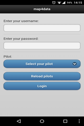
Once the app has been installed on a tablet or smartphone, any logged-in user may:
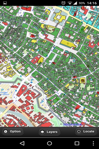
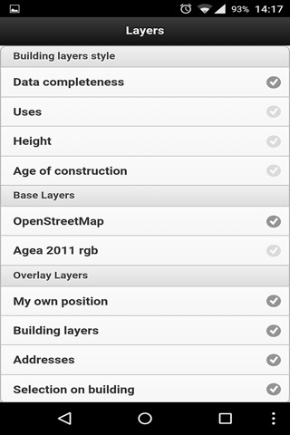
Visualize a thematic map of buildings for the city selected and check which buildings have some missing properties; indeed, the thematic map shows buildings with a “traffic light” colour code: “red” is used for buildings that have some missing information and have not yet been checked by any user, “yellow” is used for buildings that have been checked by the user but still have some missing information, “green” is used for buildings that have no missing information;
Click on a polygon representing a building and get its details (attributes);
Edit attributes, adding missing values or correcting wrong ones;
Save edits.
This mechanism allows partners to perform fast visual on-site checks, close to the building, to verify thematic completeness and correctness of data, and provide further (missing) information, or correct the inaccurate one.